Bergwandern

This page in EnglishENCette page en françaisFRĈi tiu paĝo en EsperantoEO

DE

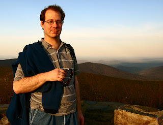
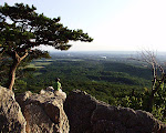
Here I am at the summit of Hawksbill Mountain, Shenandoah National Park in Virginia, in April 2009.
Close
Here I am at the summit of Hawksbill Mountain, Shenandoah National Park in Virginia, in April 2009.18-Apr-2009 18:06, Canon Canon PowerShot G9, 4.0, 7.4mm, 0.003 sec, ISO 80
 

Lassen Sie mich Ihre Reiseleiter zum Bergwandern und zur Natur sein!

Bergwandern

Das Bergwandern ist eine Lieblingshobby von Mir, und es ist einfach zu verstehen warum.  Es ist mein Lieblingsweg, aus dem Alltagstrott eine Pause zu kriegen.  Es ist ein Weg, frische Luft und einen Szenenwechsel zu kriegen.  Es ist auch die Base von einigen Freundschaften durch die Jahre.  Wenn ich Leute aus anderen Ländern kennenlerne, ich zeige ihnen oft meine Region, dazu auch fahren wir nach den Bergen und andere natürlichen Orten.  Meine internationale Freunde wollen gern ein neues Land sehen, und ich teile gern meine Heimregion ihnen mit.  Meine lokale Freunde meistens haben überhaupt keine Interesse.  Ich habe auch mehrmals über die Jahre Camping gemacht, obwohl ich das seit Jahren nicht mehr gemacht habe.  Die Fotos auf dieser Seite machte ich über viele Jahre, aus den mitten 90-er Jahre bis nun.

Hier sind einige Fotos von meinen Reisen mit Freunden aus anderen Ländern:

Fialka Grigorova at the top of Hawksbill Mountain, Shenandoah National Park in Virginia.  In front is a pot of coffee brewing.
Close
Fialka Grigorova at the top of Hawksbill Mountain, Shenandoah National Park in Virginia. In front is a pot of coffee brewing.18-Apr-2009 18:21, Canon Canon PowerShot G9, 4.0, 7.4mm, 0.017 sec, ISO 80
Fialka Grigorova, left, and myself, right, at the top of Hawksbill Mountain, Shenandoah National Park in Virginia, April 2009.
Close
Fialka Grigorova, left, and myself, right, at the top of Hawksbill Mountain, Shenandoah National Park in Virginia, April 2009.18-Apr-2009 18:07, Canon Canon PowerShot G9, 4.0, 7.4mm, 0.003 sec, ISO 80
 
Fialka Grigorova on the beach at Sandy Point State Park, with the Chesapeake Bay Bridge in the background, on the Chesapeake Bay near Annapolis.
Close
Fialka Grigorova on the beach at Sandy Point State Park, with the Chesapeake Bay Bridge in the background, on the Chesapeake Bay near Annapolis.26-Apr-2009 18:47, Canon Canon PowerShot G9, 2.8, 7.4mm, 0.017 sec, ISO 100
Fialka Grigorova at the summit of Stony Man Mountain, Shenandoah National Park in Virginia, April 2009.
Close
Fialka Grigorova at the summit of Stony Man Mountain, Shenandoah National Park in Virginia, April 2009.18-Apr-2009 15:44, Canon Canon PowerShot G9, 4.0, 7.4mm, 0.002 sec, ISO 100
 
My friend Peter Philip on the Chesapeake Bay, Elk Neck State Park, near North East, Maryland, near the border to Delaware.
Close
My friend Peter Philip on the Chesapeake Bay, Elk Neck State Park, near North East, Maryland, near the border to Delaware.21-Oct-2007 16:34, Canon Canon PowerShot G9, 8.0, 7.4mm, 0.004 sec, ISO 80
Tanja Vocke and I hiking through a crevice at Chimney Rock.
Close
Tanja Vocke and I hiking through a crevice at Chimney Rock.
 
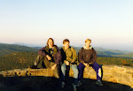
My friends Bernd, Stefan, and Olli-Pekka.  At the summit of Hawksbill Mountain, October 1996.
Close
My friends Bernd, Stefan, and Olli-Pekka. At the summit of Hawksbill Mountain, October 1996.
Strolling through the forest in autumn, Catoctin Mountain Park in Thurmont, Maryland.
Close
Strolling through the forest in autumn, Catoctin Mountain Park in Thurmont, Maryland.
 

Erste Reihe, links nach rechts: Fialka Grigorova auf der Spitze von Hawksbill Mountain, Shenandoah National Park in Virginia; Fialka Grigorova und ich auf der Spitze von Hawksbill Mountain.

Zweite Reihe, links nach rechts: Fialka Grigorova auf der Strand zu Sandy Point State Park zu Annapolis, Maryland; Fialka Grigorova auf Stony Man Mountain, Shenandoah National Park in Virginia.

Dritte Reihe: Peter Phillip auf der Strand in Elk Neck State Park, Cheseapeake Bay, Maryland; Tanja Vocke und ich auf Chimney Rock, Catoctin Park in Maryland.

Vierte Reihe: Bernd, Stefan, and Olli-Pekka auf der Spitze von Hawksbill Mountain, Shenandoah National Park; Spaziergang durch den Wald in Catoctin Park.

Die Naturparken in meiner Region sind in mehreren Kategorien…Sie sind eingeladen, durchzuschauen und entdecken!

Lokale Parks

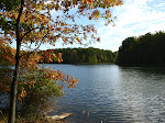
Meine Umgebung zu Hause ist alle pflach, mit Wäldern und Flüsschen.  Sie ist nicht sehr hügelig.  Es gibt aber manche sehr schöne Wanderwege, die nah und einfach zu erreichen sind.  In Maryland, mein Heimatsstaat, gibt es keine Seen in dem üblichen Sinne (es gibt keine natürliche Seen), aber es gibt mehrere Reservoirs, die aus den lokalen Flüsschen Wasser bekommen.  Manche haben auch Wälder, und es gibt einige sehr einfache und angenehme Naturwanderwege, die sehenswert sind.  Schauen Sie mal diese Orte, und stellen Sie sich vor, daß wenn Sie sie auskundschaften, sind Sie nur ein Paar Minuten weg aus der Stadt.  Viele Tage war ich schon in diesen Parks, und mein Vater brachte mich zu ihnen als ich Kind war.  Great Falls Park, die ich auch hier zeige, ist größer, natürlicher, und ist Nationalpark, der den Potomac River und den Chesapeake and Ohio (C&O) Canal nebenan enthält.

Along a lakeside path.
Close
Along a lakeside path.29-May-2011 19:40, Canon Canon PowerShot G9, 4.0, 7.4mm, 0.006 sec, ISO 80
Gathering by the lake at sunset.
Close
Gathering by the lake at sunset.29-May-2011 19:36
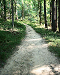
Forest trail near Meadowside Nature Center in Rock Creek Park, Rockville, Maryland.
Close
Forest trail near Meadowside Nature Center in Rock Creek Park, Rockville, Maryland.
 
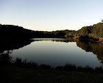
Lake Needwood at sunset, Rock Creek Park, Rockville, Maryland.
Close
Lake Needwood at sunset, Rock Creek Park, Rockville, Maryland.
Reflections, Lake Needwood, Rock Creek Park, Rockville, Maryland.
Close
Reflections, Lake Needwood, Rock Creek Park, Rockville, Maryland.
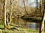
Rock Creek Park, the creek and bike path, near my house.
Close
Rock Creek Park, the creek and bike path, near my house.04-Apr-2009 15:46, Canon Canon PowerShot G9, 4.0, 9.855mm, 0.006 sec, ISO 80
 
Evergreens, Seneca Creek State Park near Gaithersburg, Maryland.
Close
Evergreens, Seneca Creek State Park near Gaithersburg, Maryland.22-Oct-2007 16:39, Canon Canon PowerShot G9, 4.0, 7.4mm, 0.013 sec, ISO 100
Lake Clopper, Seneca Creek State Park in Gaithersburg, Maryland.
Close
Lake Clopper, Seneca Creek State Park in Gaithersburg, Maryland.22-Oct-2007 14:52, Canon Canon PowerShot G9, 4.0, 7.4mm, 0.002 sec, ISO 80
One of the local residents of Seneca Creek State Park near Gaithersburg, Maryland.
Close
One of the local residents of Seneca Creek State Park near Gaithersburg, Maryland.22-Oct-2007 14:42, Canon Canon PowerShot G9, 4.8, 44.4mm, 0.004 sec, ISO 100
 
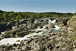
Great Falls, the rapids of the Potomac River, on the Maryland Side of the Maryland-Virginia border.
Close
Great Falls, the rapids of the Potomac River, on the Maryland Side of the Maryland-Virginia border.25-Oct-2007 02:50, Eastman Kodak Company Kodak CLAS Digital Film Scanner / HR200
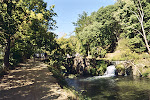
Chesapeake and Ohio Canal and towpath, Great Falls Park, Maryland.
Close
Chesapeake and Ohio Canal and towpath, Great Falls Park, Maryland.25-Oct-2007 02:50, Eastman Kodak Company Kodak CLAS Digital Film Scanner / HR200
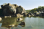
Great Falls Park in Maryland.
Close
Great Falls Park in Maryland.25-Oct-2007 02:50, Eastman Kodak Company Kodak CLAS Digital Film Scanner / HR200
 

Erste Reihe, Links nach Rechts: Pfad bei dem See, Black Hills Regional Park; Zusammenkommen bei der Sonnenuntergang, Black Hills Regional Park; Wanderweg in dem Wald, Meadowside Nature Center bei Rock Creek.

Zweite Reihe, Links nach Rechts: Lake Needwood um der Sonnenuntergang; Lake Needwood um der Sonnenuntergang; Rock Creek Park.

Dritte Reihe, Links nach Rechts: Immergrünen, Seneca Creek State Park; Lake Clopper, Seneca Creek State Park; Ein Einwohner in dem Seneca Creek State Park um Lake Clopper.

Vierte Reihe, Links nach Rechts: Great Falls Park-Wasserfall des Potomac-Flußes auf der Grenze von Maryland und Virginia; Chesapeake and Ohio (C&O) Kanal und Pfad um Great Falls Park; Felsen auf dem Wasser, Great Falls Park.

Parks in den Bergen

Diese Parks sind größer, wilder, und weiter weg.  In meiner Region,  sind sie meistens in Nord- und Westmaryland zu finden, und auch im Bundesstaat Virginia südlich von Mir.  Meistens sind die Parks natürlich, obwohl Rocky Gap State Park und Deep Creek Lake Reservoirs sind, die inter den Bergen des Westlichen Marylands versteckt sind.  Der Appalachian Trail geht durch viele von diesen Parks (der Wanderweg der aus dem Bundesstaat Maine bis zum Bundesstaat Georgia geht), denn er unterwegs Maryland und Virginia durchgeht.  Diese Parks sind meine Lieblingsparks und sind unter den spektakulärsten.  Schauen Sie mal diese Bilder!

The summit of Sugarloaf Mountain, near Barnesville, Maryland.
Close
The summit of Sugarloaf Mountain, near Barnesville, Maryland.
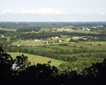
View from the parking lot, Sugarloaf Mountain, near Barnesville, Maryland.
Close
View from the parking lot, Sugarloaf Mountain, near Barnesville, Maryland.
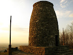
The first Washington Monument, built to honor George Washington.  Washington Monument State Park, Boonsboro, Maryland.
Close
The first Washington Monument, built to honor George Washington. Washington Monument State Park, Boonsboro, Maryland.22-Mar-2009 17:36, Canon Canon PowerShot G9, 4.0, 7.4mm, 0.004 sec, ISO 80
 
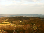
View from the old Washington Monument, Washington Monument State Park, near the Appalachian Trail in Boonsboro, Maryland.
Close
View from the old Washington Monument, Washington Monument State Park, near the Appalachian Trail in Boonsboro, Maryland.22-Mar-2009 17:20, Canon Canon PowerShot G9, 4.0, 12.733mm, 0.005 sec, ISO 80
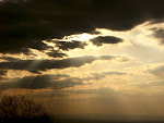
Sun bursting through the clouds, Washington Monument State Park in Boonsboro, Maryland.
Close
Sun bursting through the clouds, Washington Monument State Park in Boonsboro, Maryland.22-Mar-2009 17:09, Canon Canon PowerShot G9, 5.6, 16.822mm, 0.001 sec, ISO 80
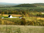
Panorama, Sky Meadows State Park, Virginia.
Close
Panorama, Sky Meadows State Park, Virginia.04-Nov-2007 16:52, Canon Canon PowerShot G9, 4.0, 25.033mm, 0.006 sec, ISO 80
 
Partly up the hill, Sky Meadows State Park, Virginia.
Close
Partly up the hill, Sky Meadows State Park, Virginia.04-Nov-2007 16:55, Canon Canon PowerShot G9, 4.0, 29.167mm, 0.006 sec, ISO 80
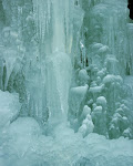
Stalagtites in Winter, Swallow Falls State Park, Western Maryland.
Close
Stalagtites in Winter, Swallow Falls State Park, Western Maryland.
Muddy Creek Falls, Swallow Falls State Park, Western Maryland.
Close
Muddy Creek Falls, Swallow Falls State Park, Western Maryland.
 
Swallow Falls, Swallow Falls State Park in Garrett County, Western Maryland.
Close
Swallow Falls, Swallow Falls State Park in Garrett County, Western Maryland.
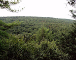
Thick virgin forest in Swallow Falls State Park, Western Maryland.
Close
Thick virgin forest in Swallow Falls State Park, Western Maryland.
Trail on the ridge, Massanutten Mountain, George Washington National Forest, Virginia.
Close
Trail on the ridge, Massanutten Mountain, George Washington National Forest, Virginia.
 
Autumn colors at sunset, Green Ridge State Park in Western Maryland.
Close
Autumn colors at sunset, Green Ridge State Park in Western Maryland.
Autumn in Green Ridge State Forest in Western Maryland.
Close
Autumn in Green Ridge State Forest in Western Maryland.
Annapolis Rock, near the Appalachian Trail by Myersville, Maryland.
Close
Annapolis Rock, near the Appalachian Trail by Myersville, Maryland.
 
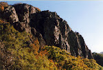
Weverton Cliffs in Maryland, by the Potomac River.
Close
Weverton Cliffs in Maryland, by the Potomac River.
Wolf Rock, Catoctin Mountain Park, near Thurmont, Maryland.
Close
Wolf Rock, Catoctin Mountain Park, near Thurmont, Maryland.
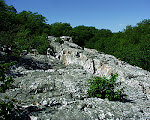
Chimney Rock, Catoctin Mountain Park near Thurmont, Maryland, in wintertime.
Close
Chimney Rock, Catoctin Mountain Park near Thurmont, Maryland, in wintertime.08-Mar-2009 16:19, Canon Canon PowerShot G9, 4.0, 7.4mm, 0.008 sec, ISO 100
 

Erste Reihe, Links nach Rechts: Aus der Spitze von Sugarloaf Mountain in Barnesville, Maryland; Aussichtspunkt des Tales von dem Parkplatz, Sugarloaf Mountain; Die erste Denkmal an George Washington, Washington Monument State Park in Boonsboro, Maryland.

Zweite Reihe, Links nach Rechts: Aus der Spitze des Denkmals, Washington Monument State Park; die Sonne penetriert die Wolken, Washington Monument State Park; Panorama, Sky Meadows State Park in Virginia.

Dritte Reihe, Links nach Rechts: Aussichtspunkt ein Teil des Weges Oben auf der Hüggel, Sky Meadows State Park in Virginia; ganz gefroren, Swallow Falls State Park im Westen von Maryland; Muddy Creek Falls, Swallow Falls State Park im Westen von Maryland.

Vierte Reihe, Links nach Rechts: Swallow Falls, Swallow Falls State Park; Urwald, Swallow Falls State Park; Massanutten Mountain, George Washington National Forest, Virginia.

Fünfte Reihe, Links nach Rechts: Herbstfarben bei der Sonnenuntergang, Green Ridge State Forest im Westen von Maryland; Bergspitze, Green Ridge State Forest; Annapolis Rocks (bei dem Appalachian Trail–Appalachen Wanderweg) in Maryland.

Sechste Reihe, Links nach Rechts: Weverton Cliffs, Potomac River, bei dem Appalachian Trail in Maryland; Wolf Rock, Catoctin State Park (neben Camp David, in Maryland); Chimney Rock, Catoctin State Park.

Siebte Reihe: Rocky Gap State Park in Western Maryland.

Einer von den Parks, Shenandoah Nationa Park in Virginia verdient besondere Aufmerksamkeit.  Skyline Drive geht durch die Berge für 105 Milen (ungefähr 170 km), geht nach oben und nach unten, und Unterwegs gibt es viele Sehenswürdigkeitn.  Es ist eine lange Fahrt aber es lohns sich.  Schau mal diese Fotos!

Sunset over Hawksbill Mountain, highest point in Shenandoah National Park in Virginia.
Close
Sunset over Hawksbill Mountain, highest point in Shenandoah National Park in Virginia.18-Apr-2009 18:47, Canon Canon PowerShot G9, 4.0, 7.4mm, 0.01 sec, ISO 100
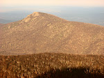
Old Rag Mountain, Shenandoah National Park in Virginia.
Close
Old Rag Mountain, Shenandoah National Park in Virginia.18-Apr-2009 18:08, Canon Canon PowerShot G9, 4.5, 36.781mm, 0.005 sec, ISO 80
 
Sunset View from Hawksbill Mountain, the highest point in Shenandoah National Park in Virginia at 4050 ft (about 1350 meters).
Close
Sunset View from Hawksbill Mountain, the highest point in Shenandoah National Park in Virginia at 4050 ft (about 1350 meters).18-Apr-2009 18:44, Canon Canon PowerShot G9, 4.0, 7.4mm, 0.013 sec, ISO 400
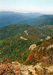
View of Skyline Drive and the Blue Ridge from Stony Man Mountain, Shenandoah National Park in Virginia.
Close
View of Skyline Drive and the Blue Ridge from Stony Man Mountain, Shenandoah National Park in Virginia.
 
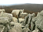
Near the summit of Stony Man Mountain, Shenandoah National Park in Virginia.
Close
Near the summit of Stony Man Mountain, Shenandoah National Park in Virginia.
Little Stony Man Cliffs, Stony Man Mountain, Shenandoah National Park in Virginia.
Close
Little Stony Man Cliffs, Stony Man Mountain, Shenandoah National Park in Virginia.
 
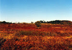
Big Meadows, just off Skyline Drive, Shenandoah National Park in Virginia.
Close
Big Meadows, just off Skyline Drive, Shenandoah National Park in Virginia.
Shenandoah River in Virginia.  Taken from Massanutten Mountain, George Washington National Forest, Virginia.
Close
Shenandoah River in Virginia. Taken from Massanutten Mountain, George Washington National Forest, Virginia.
 

Erste Reihe, Links nach Rechts: Sonnenuntergang aus Hawksbill Mountain, der höchste Punkt des Parkes um 1350 Meter; Old Rag Mountain.

Zweite Reihe, Links nach Rechts: Aussichtspunkt aus Hawksbill Mountain; Skyline Drive aus Little Stony Man Felsen, Stony Man Mountain.

Dritte Reihe, Links nach Rechts: Bäume zu der Spitze von Stony Man Mountain; Little Stony Man Felsen.

Vierte Reihe: Isolierung um Big Meadows in der Mitte des Parkes. Dieser Platz ist gleich nebenan Skyline Drive, aber fühlt sich sehr weit von alles; Aussichtspunkt von Shenandoah National Park und dem Fluß Shenandoah, aus der anderer Seite vom Shenandoah Tal.

Parks auf dem Mer

Selbstverständlich sind diese Parks total anders–sie sind im östlichen Teil Marylands, und sind direkt auf dem Mer und sind pflach.  Sie sind auf der Chesapeake Bay (Bai), die die Mitte Marylands aus der Östlichen Küste (Eastern Shore) aufteilt, und auf der Atlantikküste.  Ich bin weniger oft in dieser Gegend, aber sie sind sehr willkommen als Wechsel von meiner Region.  Schauen Sie mal diese Orten an!

Sunset over the Chesapeake Bay Bridge, from Sandy Point State Park near Annapolis, Maryland (by the Chesapeake Bay).
Close
Sunset over the Chesapeake Bay Bridge, from Sandy Point State Park near Annapolis, Maryland (by the Chesapeake Bay).25-Apr-2009 18:41, Canon Canon PowerShot G9, 4.0, 7.4mm, 0.013 sec, ISO 200
Trees above the Chesapeake Bay, Elk Neck State Park, near North East, Maryland, near the border to Delaware.
Close
Trees above the Chesapeake Bay, Elk Neck State Park, near North East, Maryland, near the border to Delaware.21-Oct-2007 17:39, Canon Canon PowerShot G9, 4.0, 7.4mm, 0.004 sec, ISO 80
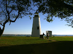
Turkey Point Lighthouse, Elk Neck State Park, near North East, Maryland, near the border to Delaware.
Close
Turkey Point Lighthouse, Elk Neck State Park, near North East, Maryland, near the border to Delaware.21-Oct-2007 16:55, Canon Canon PowerShot G9, 8.0, 7.4mm, 0.005 sec, ISO 80
 
On the Chesapeake, Elk Neck State Park, near North East, Maryland, near the border to Delaware.
Close
On the Chesapeake, Elk Neck State Park, near North East, Maryland, near the border to Delaware.21-Oct-2007 16:33, Canon Canon PowerShot G9, 8.0, 7.4mm, 0.008 sec, ISO 80
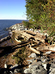
View of the water from Elk Neck State Park, near North East, Maryland near the border to Delaware.
Close
View of the water from Elk Neck State Park, near North East, Maryland near the border to Delaware.21-Oct-2007 15:38, Canon Canon PowerShot G9, 4.8, 44.4mm, 0.002 sec, ISO 80
Ponies in the marsh, on the Virginia side of Assateague Island, on the Atlantic Coast.
Close
Ponies in the marsh, on the Virginia side of Assateague Island, on the Atlantic Coast.
 
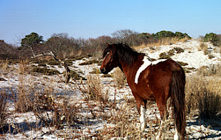
Pony on the beach, Maryland Side, Assateague Island, Atlantic Coast.
Close
Pony on the beach, Maryland Side, Assateague Island, Atlantic Coast.
 

Erste Reihe, Links nach Rechts: Sandy Point State Park, auf der Cheseapeake Bay zu Annapolis, Maryland, mit der Bay Bridge (Bai Brücke) in der Hintergrund; Elk Neck State Park, Cheseapeake Bay, nordöstliches Maryland bei Delaware; Turkey Point Lichtturm, Elk Neck State Park, auf der Cheseapeake Bay, Maryland.

Zweite Reihe, Links nach Rechts: Chesapeake Bay, Elk Neck State Park, Maryland; Cheseapeake Bay aus Elk Neck State Park; Assateague Island (Virginia Seite).

Dritte Reihe: Assateague Island (Maryland Seite), einheimisches Pony.

Die Pony auf Assateague Island sind einmalig und sind nur auf dieser Insel gefunden.  Wie sie dorthin kamen und woher ist eine Rätzel!

Langlauf

Meiner Meinung nach, das Langlauf ist der beste Sport Winters, und mir gefällt das viel besser als Skifahren.  Es ist eine gute Mischung von Skilaufen und Bergwandern, und ich finde es besser als Skifahren denn ich weniger Probleme mit Hoheangst habe als beim Skifahren.  Wenn man weißt, wie sich auf den Langlaufskiien zu bewegen, kann man viel schneller und effektiver gehen als nur mit den Füßen, und viel Land überqueren.  Die Fotos hier sind aus Canaan Valley, West Virginia, eine der besten Orten in meiner Region, Langlauf zu machen.

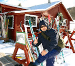
My friend Mason Callejas putting on his cross-country skis, at Whitegrass, in Davis, West Virginia, December 2008.
Close
My friend Mason Callejas putting on his cross-country skis, at Whitegrass, in Davis, West Virginia, December 2008.07-Dec-2008 12:58, Canon Canon PowerShot G9, 4.0, 7.4mm, 0.002 sec, ISO 100
Cross-Country skiing at Whitegrass, Davis, West Virginia.
Close
Cross-Country skiing at Whitegrass, Davis, West Virginia.07-Dec-2008 13:17, Canon Canon PowerShot G9, 5.0, 7.4mm, 0.001 sec, ISO 100
 
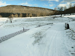
Cross-Country ski trail at Whitegrass, near Davis, West Virginia.
Close
Cross-Country ski trail at Whitegrass, near Davis, West Virginia.07-Dec-2008 14:20, Canon Canon PowerShot G9, 4.0, 7.4mm, 0.001 sec, ISO 80
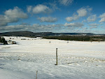
Snowscape at Whitegrass Cross Country Ski Area, near Davis, West Virginia.
Close
Snowscape at Whitegrass Cross Country Ski Area, near Davis, West Virginia.07-Dec-2008 14:19, Canon Canon PowerShot G9, 4.5, 7.4mm, 0.001 sec, ISO 80
 

Oben Links nach Rechts: Mein Bekannter Mason Callejas stellt seine Skien an vor der Ende der Loipe; Aussichtspunkt des Parkplatzes und Chalet under dem Berg, aus der Loipe; Auf der Loipe zu Whitegrass.

Unten Links nach Rechts: Auf der Loipe zu Whitegrass; Panorama aus der Loipe zu Whitegrass.

Hier ist ein Video von meinem Bekannter Mason Callejas, von der Zeit daß wir zusammen Langlauf machten, in Dezember 2008.

Wenn Sie mit Mir Langlaufen oder Bergwandern machen möchten, bitte melden Sie sich bei Mir!  Ich habe auch viel mehr Fotos und Videos von Bergwandern und der Natur in meinen Internetgallerien zu YouTube, Google Picasa, und Ipernity.  Wenn Sie möchten, können Sie auch die Picasa und Ipernity Gallerien wie Diashow ansehen.

Leave a Reply

Your email address will not be published. Required fields are marked *

This site uses Akismet to reduce spam. Learn how your comment data is processed.